Lost Landscape
消失的風景


Lost Landscape
2023
Material: Canvas with wooden frame
Artwork for the opening programme of the Hong Kong Arts Development Council’s new premises, Marginal Notes, is curated by Ying Kwok.
Special thanks to: Lai Mai Yee, Tang Yuk Lan, Dor Dor, 朱淑芬, 朱淑霞, Alice, Christine Yau, Connie Lau, Esther Kwok, Eve Chui, Peggy Chan ,Polly, Sue Ng, Sui Ying ,Sze Ting, Yiu Yiu, Mis Jie
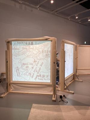
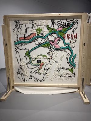
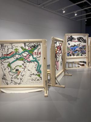
由四幅刺繡作品組成,每幅重現了不同年代的黃竹坑地景面貌。藝術家經深入研究不同時代和來源的黃竹坑歷史地圖。藝術家對這些地圖上引人入勝的色彩和精緻的形狀著迷,開展了一次深刻的探索,揭示了這個地區發展的不斷變化的錦繡圖景。
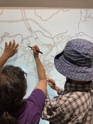
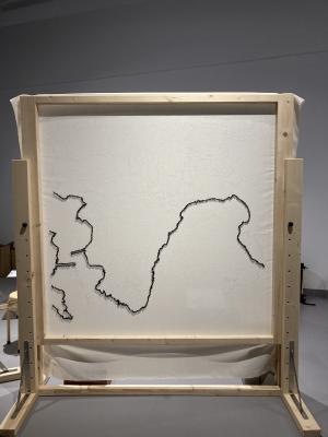
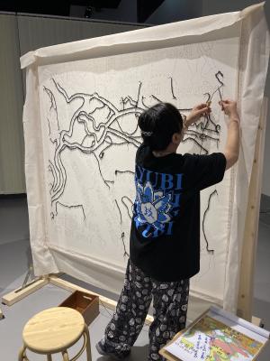
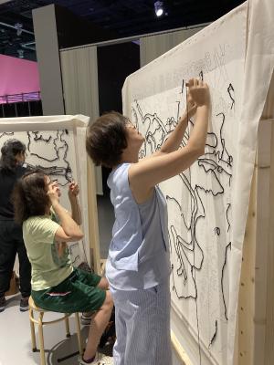
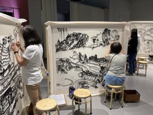
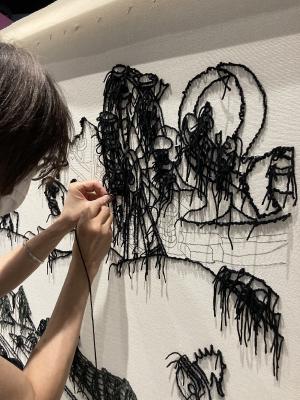
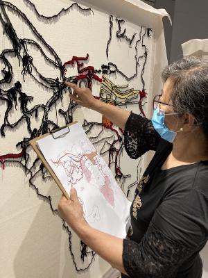
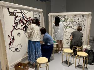
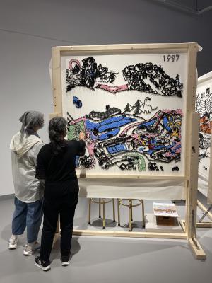
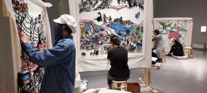
藝術家是作品的發起人,負責設計及勾畫地圖,同時邀請本地婦女與現場觀眾共同製作, 用刺繡的方法一針針地沿地圖的線遊走。隨著展覽的進展,作品將不斷成長和轉變,藝術家會邀一起討論和改進,反映出城市發展中的不確定性。
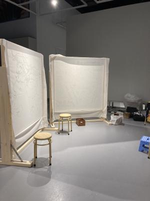
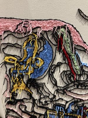
Comprising of four embroidered tapestry works, each piece beautifully showcases the urban scenery of Wong Chuk Hang across different eras. Through extensive research and reference to historical maps of Wong Chuk Hang published by various sources and cartographers from different time periods, the artist skillfully recreates the urban landscapes of five significant periods, incorporating her creative thoughts and interpretations. With a vibrant palette, precise lines, and intricate shapes, the artwork captures the essence of Wong Chuk Hang’s evolving cityscape, including the fading remnants of old buildings and landscapes altered over time, as well as the uncertainties of urban development, offering an immersive opportunity for the audience to discover and explore.
The artist extends an invitation to local women and on-site viewers to actively participate in the creation of this artwork. Employing the meticulous technique of punch needle stitching, they navigate the spaces outlined in the artist’s blueprint, carefully filling them stitch by stitch. As the exhibition progresses, the artist engages in discussions and collaboration with the women, continuously refining and improving the artwork. This dynamic process mirrors the ever-evolving nature of our city, as the artwork grows and transforms alongside it.
There are 4 maps of Wong Chuk Hang:
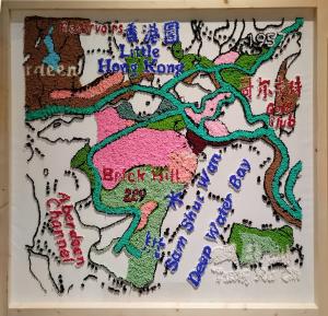
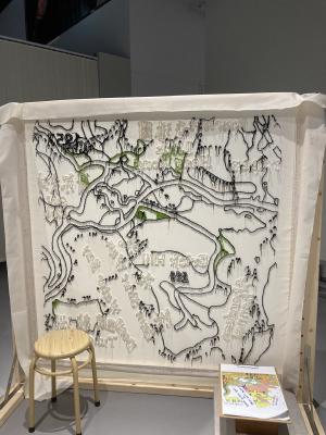
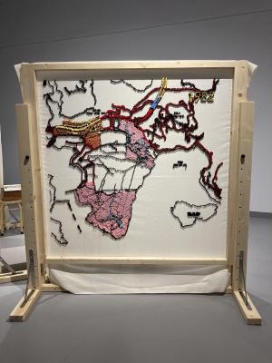
Map 1957 - This is a relatively complete historical map that I found. It was hand-drawn and clearly shows the traffic routes and names of various areas in this area, which is a bit different from that of Hong Kong today. However, some parts still exist or have not changed much, proving that Wong Chuk Hang has not been completely transformed .
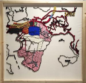
Map 1982 - This map shows the transportation development of Wong Chuk Hang. The construction of new tunnels and the cable car connecting Ocean Park and the paths in the park (the pink of the map is the scope of Ocean Park) are all shown. I installed the 1957 and 1982 map together and you can compare the traffic development over the past 25 years.
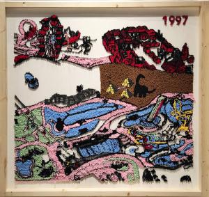
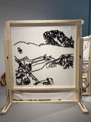
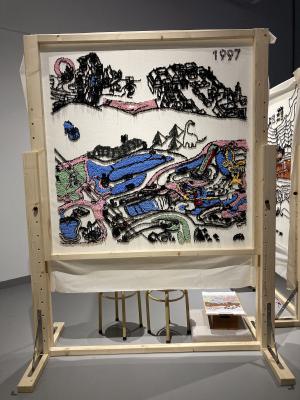
Map 1997 - A hand-drawn map published by the Ocean Park Corporation in 1997. It was drawn by an illustrator from Hong Kong, so there were a lot of interesting images. This is believed to be the last map of Ocean Park that was drawn by hand. All subsequent maps were turned into computer drawings. Ocean Park is the collective memory of Hong Kong people in the 1990s. The park’s motorized roller coasters, the Gikou Village at the entrance and the most popular Ocean Theater have all become the purpose of everyone’s visit to Wong Chuk Hang. Ocean Golden Park has gone through a lot of changes in the past 20 years. For me, 1997 was its golden year.
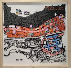
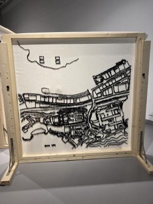
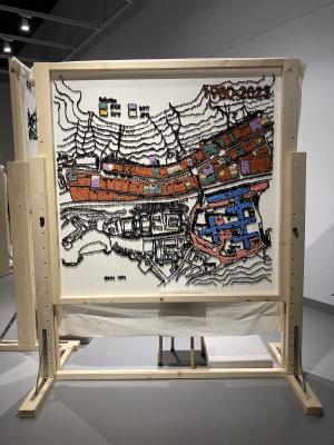
Map 1980-2023: This is a map of Wong Chuk Hang Industrial Estate, which originated from the booming industrial development of Hong Kong. This was the place where plastic flowers, toys and clocks were produced. However, due to the decline of industry, art galleries began to move into the area in 2017, so I used a hand-drawn map of the industrial area in the 1980s, using colors to represent the art galleries of different eras, to see the changes in the area. Interestingly, the factory buildings have only changed uses, but in fact the architecture and geography remain the same as they were in 1980.The biggest change is the redevelopment of Wong Chuk Hang Village (the pink and pink blue parts), which is a subway station and a new private real estate project now.